Switzerland has some of the most enjoyable trail running I have done to date. The running in Val Ferret, near the Italian/French border, is no exception. Here is another post on some highlight trail runs. I based myself in a small town called La Fouly, which is almost at the end of the valley before you run into the border to Italy. La Fouly is along the Tour du Mont Blanc, so it is quite busy. There is a campground in town with good amenities, although expect a lot of people in July and August. Compared to Fionnay/Bonatchiesse, which was more isolated and quieter, there is a grocery and sports store in La Fouly. There is bus connection to Martigny (where you can get a train to Chamonix) and other towns in Switzerland. In addition to trail running, there is a climbing sector called Prise d’eau de Saleina with good beginner/intermediate routes that is within hiking distance of La Fouly (about 2 hours) or you can drive and shorten the hike (crag book for sale at the camping). I especially liked the wall next to the river, although beware that the river fluctuates in volume, which scared us the first time as we thought the climbing area might get flooded!
Out and back from La Fouly – Bivouac du Dolent – La Fouly
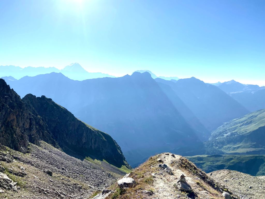
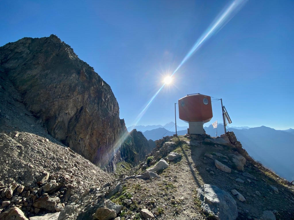
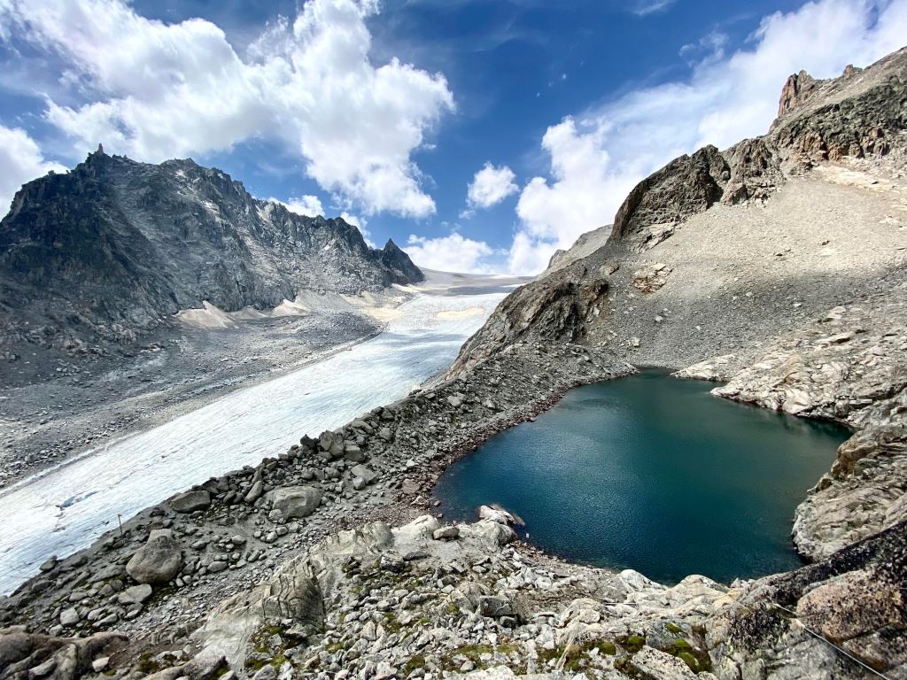
This was a shorter run (about 10 km) and very easy to navigate. Once you are on the trail, which is near the La Fouly campground (use SwissTopos to find it), there is no other place to go but to follow the red/white markings until you get to the Bivouac du Dolent. The run starts at about 1592 m and climb up to 2671 m in a short amount of time. The ascent was steep at the beginning and, as it had not rained in many days, the paths very slippery with dry sand and rock. There was also a section of ladders and chains at the beginning, which some might find unpleasant, but I think adds a bit of variety (and helps you get up high, quick). The bivouac is a strange round orange structure with beautiful views over the edges of the Glacier du Dolent and the peaks around Mont Dolent. You can spend the night at the Bivouac if you bring your own food/supplies.
A loop from La Fouly – Grand Col Ferret – Petit Col Ferret – La Fouly
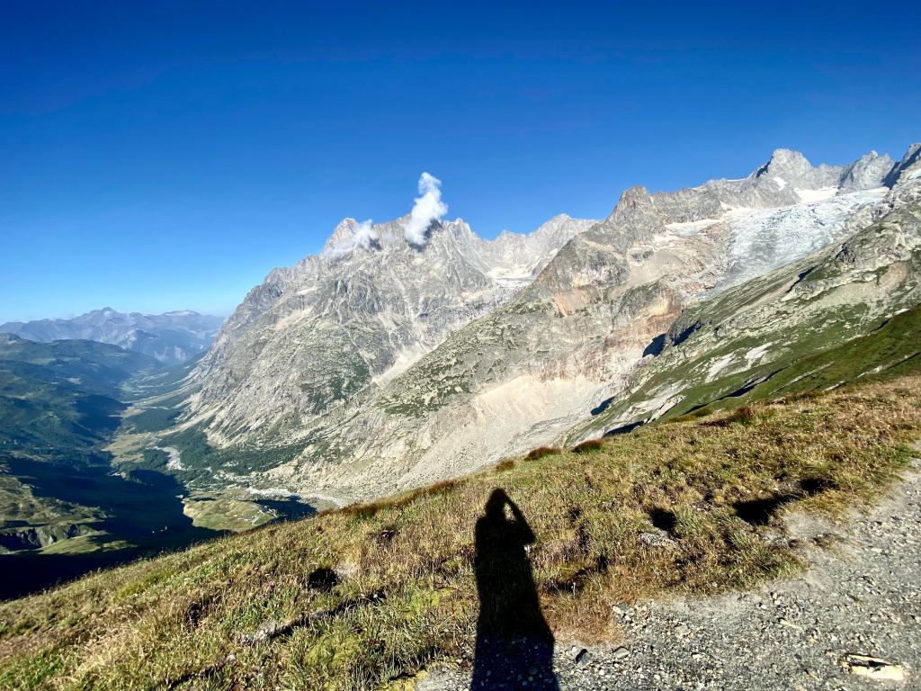
This is a beautiful run with wonderful variety in terrain and view. Starting from la Fouly, I ascended up the green Swiss mountainside to le Grand Col Ferret (2536 m). This side of the run was wetter, with cows graving in the hills and fog floating around the mountains. When I reached le Grand col, the weather cleared and the Italian Aosta valley and the Mont Dolent chain came into full view. From le Grand Col, I ran up to the higher point at Tête de Ferret at 2713 m (just a short hike up, but quieter than le Grand Col which is part of the Tour du Mont Blanc) and then down the other side to the Petit Col Ferret (2486 m). From the Petit Col, you run back down towards La Fouly. I had a slice of delicious pie at Gîte de la Léchère before finishing the descent to town.
La Fouly – Prise d’eau de Saleina – Cabane d’Orny – La Breya – Champex Lac
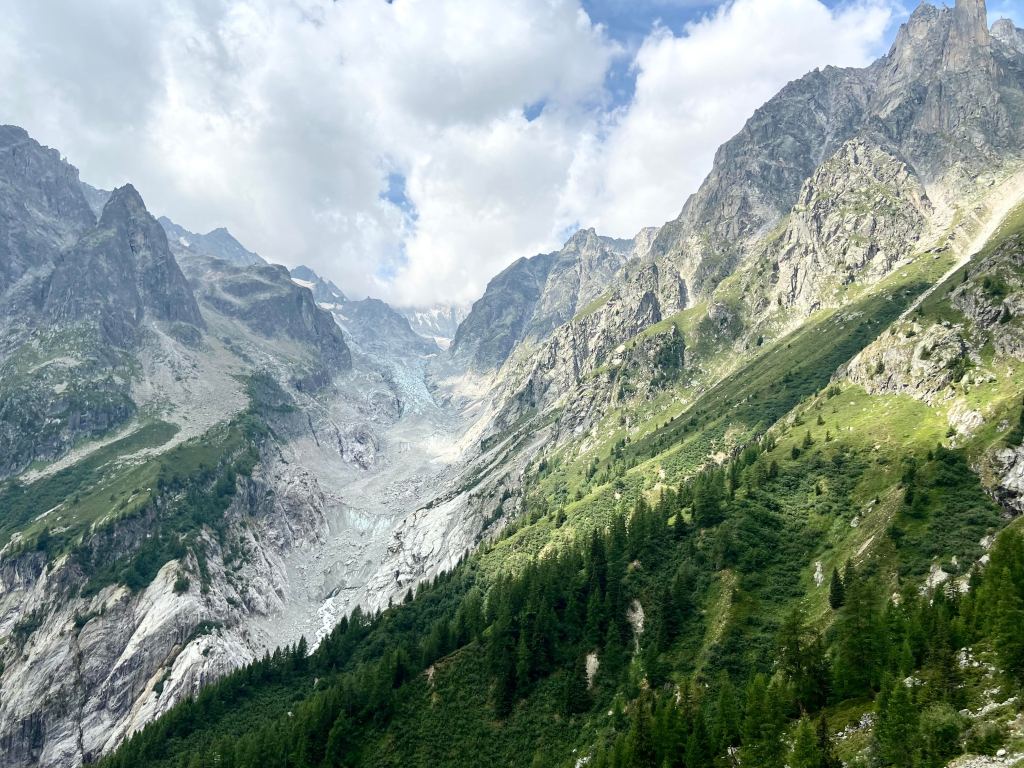
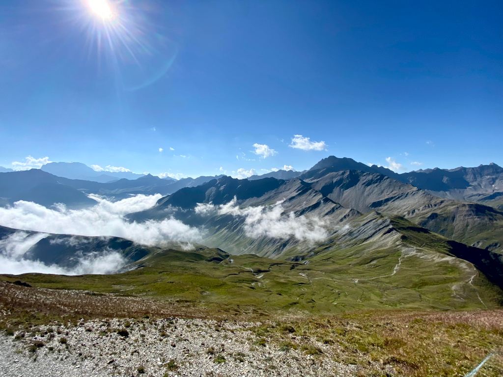
This felt like a long and hard run, but the views were incredible and the terrain quite varied. The first section from La Fouly to near the Prise d’eau de Saleina is mostly a long forest trail, making it a good warm-up. After that, from the Prise d’eau, it is a relentless ascent until Cabane d’Orny (2825 m). That said, the views are stunning with a huge waterfall and views over the glacier. At the Cabane, I bought a bottle of water and hot soup before descending via another trail to Champex-Lac. This trail was dominated by a long balcony, making the running quite comfortable and easy. After the La Breya chairlift, it became less pleasant with a steep descent into the valley.
