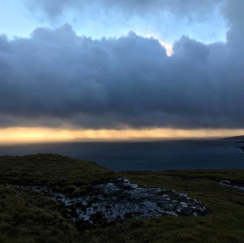
It turns out October in the Faroe Islands is an unpredictable, blustery, and wet time of the year (or we just had the most ill-timed adventure). I’ve compiled a few hikes and trail runs below that would all be fantastic on a sunny day with more predictable weather. During my stay, the weather was just incredibly tricky to put it mildly (or more like left me swearing in a ditch as winds battered me so hard I could not see and everything I owned got soaked and phone destroyed even when in a dry bag). Some general words of caution: bring spare rain gear in your trail running pack and be prepared to abandon your run because of bad weather and return home without feeling too guilty.
Streymoy island
Trail run from Kirkjubøur to Tórshavn

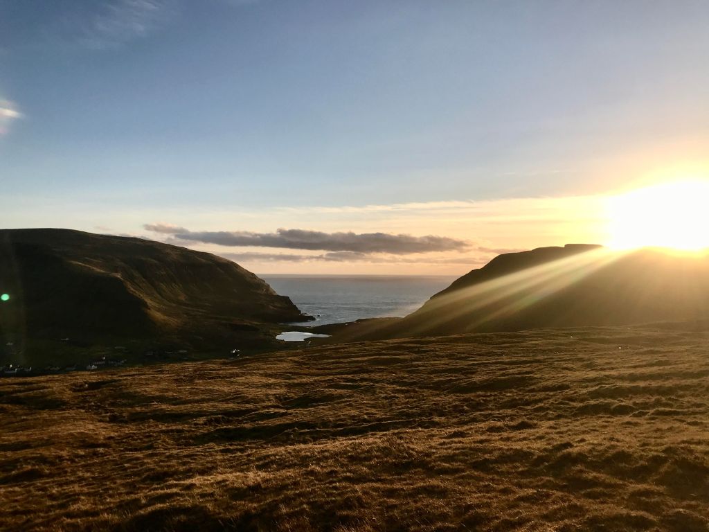
Our trip started on Streymoy island, which is noted to be the largest and most populated island in the Faroes and where the capital city, Tórshavn, is located. (The airport is on Vágar island, but you can take a bus or a very expensive cab ride into Tórshavn via the undersea tunnel). I managed to get in a short trail run early the next morning after we arrived. I left at 7:40 am on a bus from Tórshavn to Kirkjubøur, the most southern village on the island of Streymoy. The bus ride with dawn rising over the ocean and landscape was worth the trip alone. From Kirkjubøur, I took the mountain trail back to Tórshavn (following this Wikiloc trail). The footpath was well-marked (with large cairns), although slightly trickier as Tórshavn came into view and the cairns became more spaced out (although at this point you could see Tórshavn). The trail was relatively easy, although very boggy, slippery, and wet. The dusting of snow over the landscape was magical. While I ran this one-way – which was an easy run, only about 6-7 km and finishing in the center of Tórshavn – it would have been an easy out and back run as well. You get different views depending on which direction you are heading, so not at all dull. I found this footpath to be a great introduction trail to the Faroe Islands: relatively easy to navigate, not too many steep bits (only out of Kirkjubøur and down into Tórshavn), and splendid views over the ocean.
Suðuroy island
Trail run from Hvalba to Sandvik

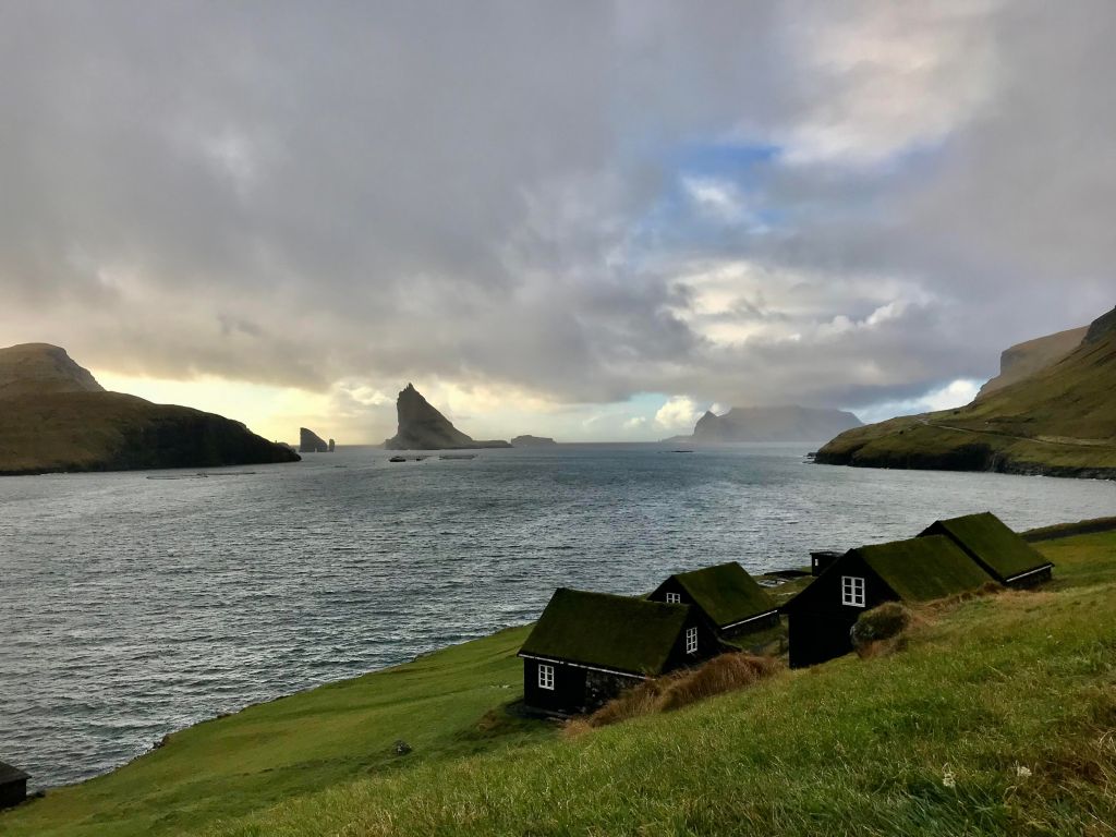
After a night in Tórshavn, we took the afternoon ferry to Suðuroy island (the most southern island in the Faroes), ending at the Krambatangi ferry terminal just outside the villages of Trongisvágur and Tvøroyri. From there, we took the bus to the small village of Hvalba, about 11 km away. The town is wedged between the ocean on two sides and tunnels on the other two. After the first evening, the weather became increasingly challenging. I managed to get in a beautiful walk on the mountain trail between Hvalba and Sandvik before everything turned wet, although I never made it the full way (it’s not a long walk, but I ran out of daylight one evening, and the next day the weather was just too wet with intense winds). The start of the trailhead is marked from the main road in Hvalba, and is located around here. You will have to exercise a bit of common sense to get to the first large cairn, but basically go through the gate at the top of the road (passing over someone’s driveway) and then climb steeply (this part is quite steep) up and up. A good part of the first section of the hike is near a sheep fence, which helps if the fog starts to roll in. It eventually starts to flatten out a bit and becomes more comfortable to walk.
Trail run from Tvøroyri to Hvannhagi
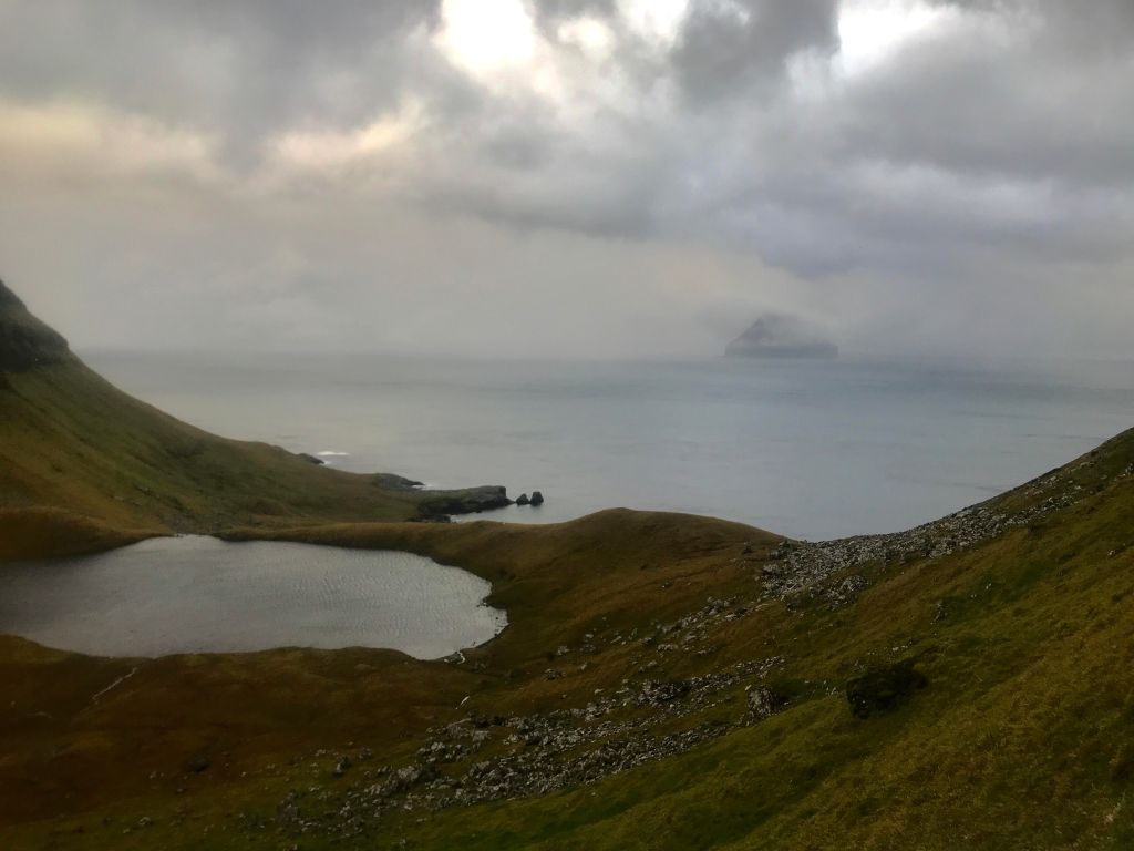

After Hvalba, we took the early morning bus from the grocery store in Hvalba to Tvøroyri. I tried a few different trail runs around here, but the weather was horrific. This run to Hvannhagi ended up being beautiful, bad weather and all, but also relatively treacherous. The footpath was so wet that I slid several times, and once precariously close to tumbling down the grassy hillside towards the sea. I also followed this Wikiloc trail which ended up not following the marked path so there was a scramble at the end. If you do follow the marked path, you will see little wood sticks in the ground marking the way. The path starts around here, above the hospital in Tvøroyri, continues cutting across the mountainside above Tvøroyri, and then looping towards the ocean. Once you get to the view over the ocean, you can go through a gate and continue steep down a path. You then loop towards the left and have a beautiful view over a lake and the ocean. This trail is marked as not particularly difficult by the Faroese travel guides, but I found the footing very challenging in poor weather of brutal winds and pelting rain. Safe to say, I did not see another person on the trail.
Trail run from Tvøroyri to Nakkur

This was a ‘good’ path for bad weather running that leaves from near Froðba. The path starts here, just above Froðba, a small village just next to Tvøroyri. The path is an old and wide tractor road so there is no real risk of tripping and falling in bad weather, or getting lost. At the same time, the views over the Atlantic Ocean are exquisite and, at Nakkur (325 m), you can see what I think is Litla Dimun, the smallest island in the Faroes (be careful at the top, it was not clear to me whether it was a straight drop on the other side and the wind could have blown a light person over). Also, the tractor road apparently continues further up to about 400 m elevation at Froðbiarkambur (see this walking map) but I didn’t make it on both attempts – the wind and the rain were too strong.

Vágar island
Road run from Sørvágur to the start of the tunnel to Gásadalur
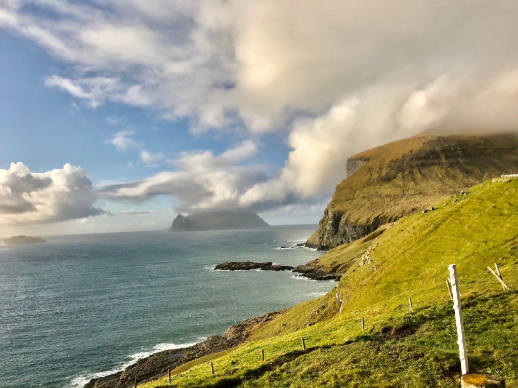

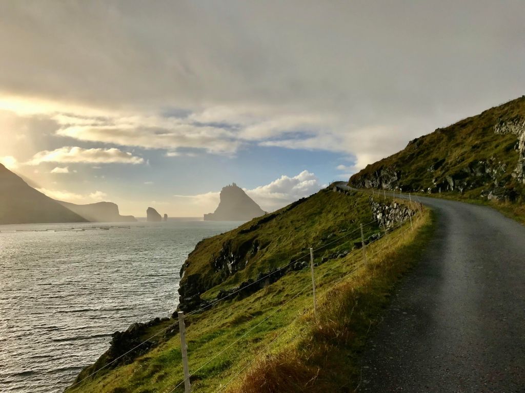
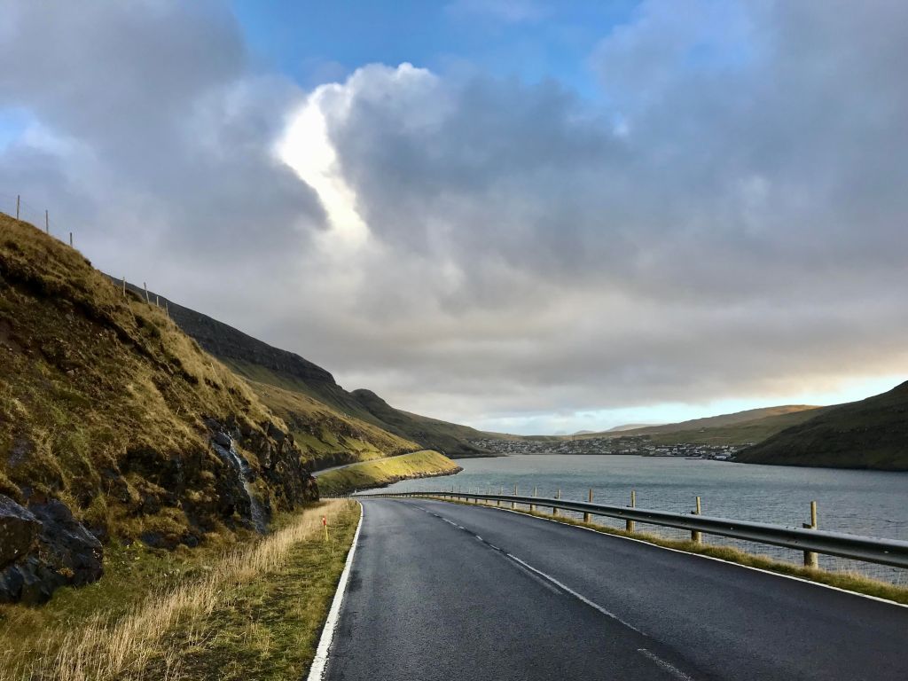
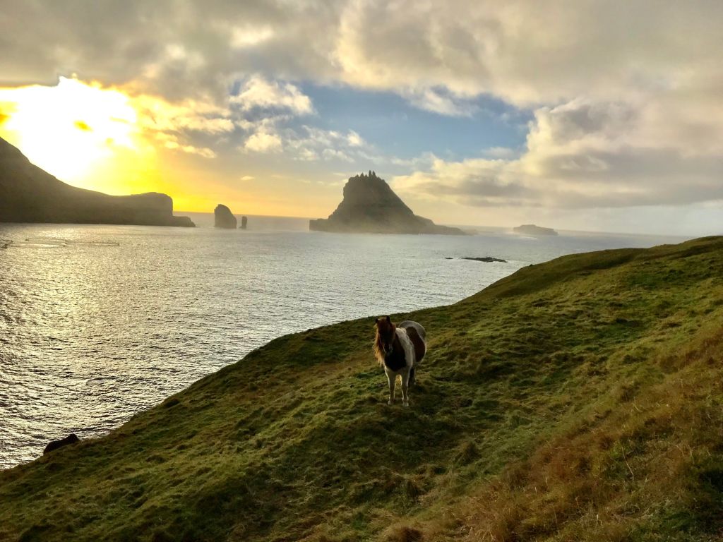
This is one of the single most spectacular road runs I have done in a long time. It starts from the village of Sørvágur and follows the beautiful coastal road to the tunnel head where you can access the much-raved village of Gásadalur (walking through the tunnel seems like a very bad idea, but if you’re an experienced hiker I have read that you can walk over the mountain on the old postman’s trail when there’s good weather, or you can schedule a bus from Sørvágur to Gásadalur and back). The run itself is only about 12km as an out and back from Sørvágur to the start of the tunnel and on a rolling road with a beautiful view over the ocean and the islet of Tindhólmur with its unique shape in the distance. You will also pass the village of Bøur, which is exquisite, so make sure to take the quieter lower road through the village rather than the main upper road when that option presents itself. I did this as a walk the first day in pouring rain and brutal winds, which was not fun. I came back the next day and did the same loop in sunshine and it was some of the most beautiful views I have had in the Faroe Islands to date, with the added bonus of not having to worry about getting lost if fog randomly set in. Sørvágur is in walking distance to the airport, so this could make a great final day trip, or even a day trip from Tórshavn (if you do that, consider taking the bus to Sørvágur from Tórshavn and then the Atlantic Airways helicopter back to Tórshavn, which is not at all expensive and great fun even in rain and wind).


A short ramble near the airport


Finally, I couldn’t resist a short walk before my flight took off. I started this trail from the airport, following the gravel road that you can see from the parking lot. Through two gates, crossing the highway, and then continue down this gravel road until it reached its end. The views were spectacular and the sun finally out. I walked about 6-7km out and back making this a leisurely stroll.
