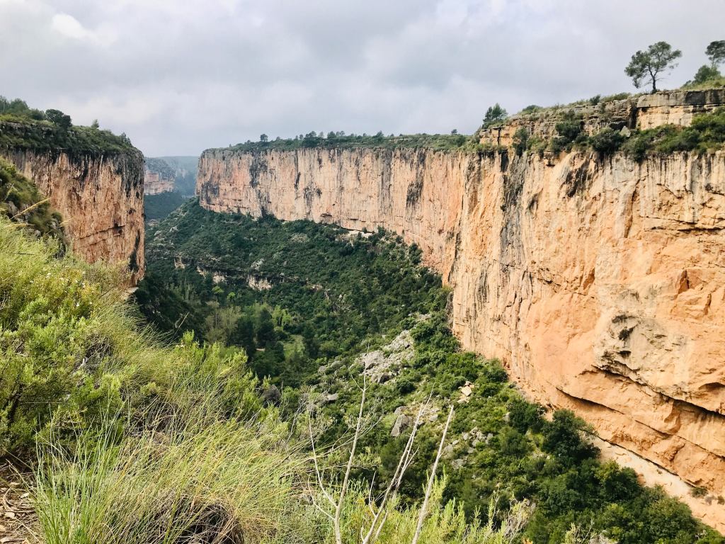
Chulilla, a beautiful town nestled into rock in the community of Valencia, is an incredible location for easy access to breathtaking trail running, rambling, and rock climbing in nearby El Paraje Natural Municipal “Los Calderones”.
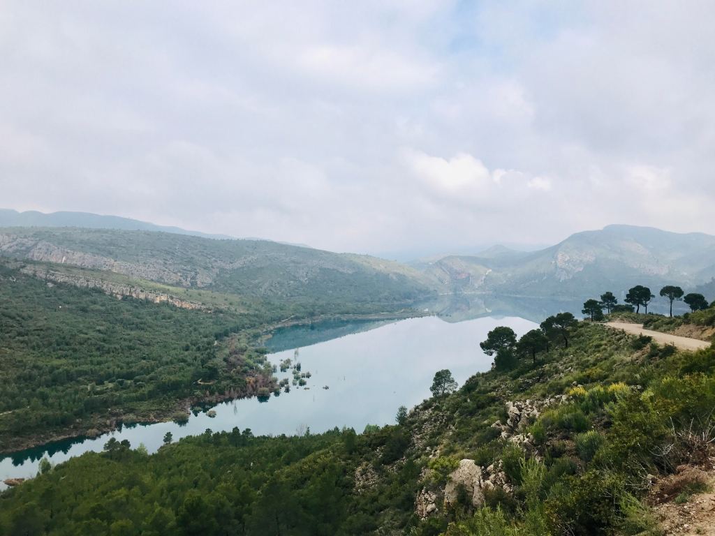
Chulilla – Embalse de Longuilla – Chulilla via Puentes Colgantes. My favourite was a trail run leaving from the Parking el Barranquillo entrance just under the town itself. I took the trail towards Sot de Chera (another beautiful mountain town). Instead of running all the way to Sot de Chera, I took the intersection towards the Embalse de Longuilla. From the embalse you can run back to Chulilla via the Puentes Colgantes. The smell of lavender bushes in the low-lying forest, the clear waters of the embalse in the distance, and the quiet serenity of huge limestone walls in the gully of the canyon are something to behold. The trail was relatively well-marked, and easy to follow on maps.me.
Chulilla – Cima del Frailecico – Chulilla via las cuevas. The trail from Parking el Barranquillo to Cima del Frailecico is another picturesque run. After reaching the cima, you can double back to the parking lot from the summit or take the longer route back to Parking el Barranquillo via the cuevas (caves). The start of the route towards the caves is well-marked from the cima but it was useful to have an app to check I stayed on route. The rock formations made the trail sometimes hard to follow, particularly when it cut across slopes. I ended up walking longer portions because I was worried my ankles would break on the irregular floor, but this only offered the added benefit of being able to better enjoy a clear view over to Chulilla – a cluster of small white buildings hugging rock in the distance.

Chulilla – Mirador de la Cruz – Chulilla. Finally, a shorter favourite, was running from Chulilla up to Mirador de la Cruz, which also looks over the entire town (here is a Wikiloc map from another runner). The initial scramble from Chulilla is relatively steep, but soon rewarded by a breathtaking view of the town and the valley. Once up on the ridge, the path tracks the steep drop until the mirador with unimpeded views over the canyon.
